![]()
PAGE 19

by Jerry Adams, copyright � 1997, all rights reserved
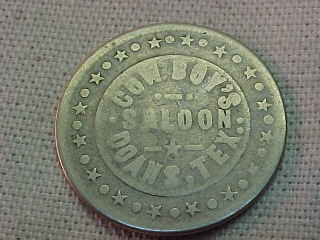
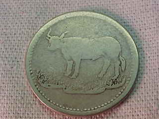
the token:
COWBOY'S / SALOON / DOANS, TEX.
(stars and circles around border) (steer facing left on a mound)
white metal - round - 25mm (circa: 1870's-1890's, estimated value: $600)
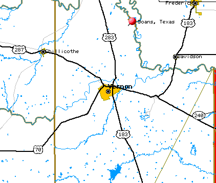
Among the old west cow towns, some were wild and wooly, such as Tascosa, Texas, Dodge City, Kansas, Abilene, Kansas, Ft. Griffin, Texas, and Wichita, Kansas. Others were on the cattle trails but had a less sullied image, such as Doans, Texas.
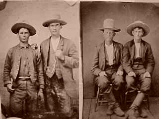
tintype photos from author's collection
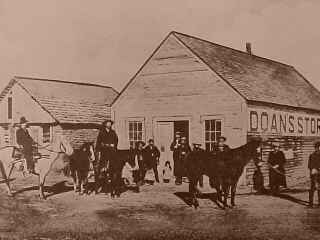
The Western (Dodge City) cattle trail came north from Ft. Griffin, Texas, to the Red River at a spot called Doan's Crossing. At this point Judge Jonathan Doan and his nephew, (Ohioan) Corwin F. Doan, established a large store which sold whiskey, guns, ammunition, blankets and saddles to the drovers moving herds north from Texas into the Indian Territory. The next stop on the trail after Doans store was Camp Supply. The Chisholm Trail was east of the Western Trail and predated it. The Chisholm Trail was in major use from about 1866 until 1876, then the Western Trail through Doan's Crossing became more heavily used for a number of reasons, including wire fences in the east. The first use of the Western trail was in 1874.
For nearly two decades, this was the last stop before the 300 mile push through Indian country to Dodge's railheads. This all came about at the end of the Civil War, when returning Confederate soldiers found the longhorn cattle outnumbering men ten to one. A six dollar steer in Texas was bringing thirty dollars up north, and most could do that math.
Some of the names that passed through Doan's crossing included Dan Waggoner, Shanghai Pierce, Charlie Goodnight, and George Littlefield.
In those two decades, an amazing six million cattle and cowponies, and 30,000 riders traveled the "Western and Kansas Trail" for Dodge City.
By 1883, Texas cattlemen petitioned Congress for a fenced-off right of way, clear to Canada. They wanted a three mile wide fenced cattle highway, with gates for grazing and handling facilities at all railheads, but Congress said no.
Today, little is left, the highway runs into the Red Rivers hill banks fifteen miles northeast of Vernon, Texas. Signs say roads end, and "Doans". Several old houses are scattered among elms and willows, and nothing but a granite marker marks this historic spot.
on to page 20 of our token web pages...
updated: 5 feb 2000